Generating building platforms
Building outlines and villa identifiers were used to generate and organise Civil 3D platform surfaces through a single Dynamo workflow. The process could be repeated as the masterplan changed.

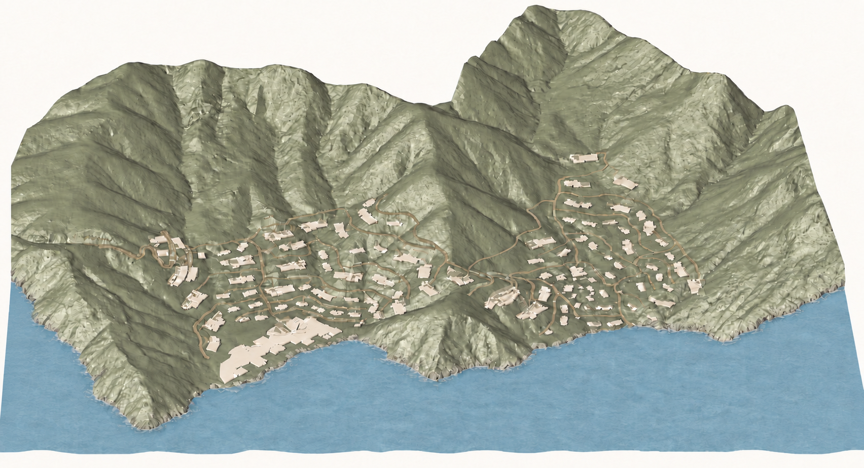
Finding a way through complex terrain, with engineering that works with the landscape.
The proposed luxury resort brings together villas, resort facilities and timber and bamboo buildings within a landscape of steep slopes and natural waterways. The design considered how access, infrastructure and building platforms could work with the terrain, limiting unnecessary earthworks and disturbance while addressing the practical challenges of construction.
Road alignments, building levels and earthworks were developed together, with each adjustment assessed against the surrounding terrain and architectural masterplan.
Three-dimensional infrastructure models, supported by in-house Python and Dynamo workflows, enabled alternative layouts and levels to be assessed as the masterplan evolved. This brought access, drainage and building platforms into a coordinated view of the site.
The buggy-path network was developed in consultation with the resort operators. Maximum gradients were reviewed against the capabilities of the intended vehicles, while distances along the sloping routes informed discussions about journey times between villas, reception and resort facilities.
Alignments and levels were coordinated with villa entrances, drainage, retaining structures and earthworks. The studies explored how operational needs could be accommodated while limiting steep sections, extensive cutting and elevated paths.
Undisclosed
DL2A, France; RPA; Linear Vista
2023–ongoing
Approx. 71 acres
Structural engineering
Geotechnical engineering
Civil engineering
Design
On steep terrain, moving a villa or adjusting a path can affect platform levels, stilt heights, retaining structures and earthworks. In-house Dynamo and Python workflows supported repeated assessments of these changes, helping the design team keep the infrastructure coordinated with the evolving masterplan.
Building outlines and villa identifiers were used to generate and organise Civil 3D platform surfaces through a single Dynamo workflow. The process could be repeated as the masterplan changed.
Contour, slope and elevation analyses informed the assessment of building levels. Stilt and retaining-height studies highlighted areas where the proposed platforms required further review against the ground profile and construction constraints.
Custom Python functions extended Dynamo to update profile data bands across 19 section sheets in bulk, supporting coordinated drawing updates as the infrastructure model developed.
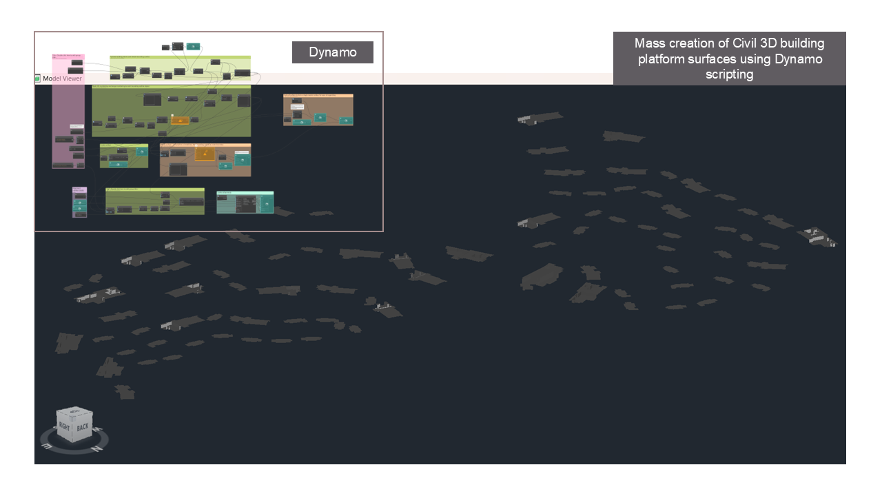
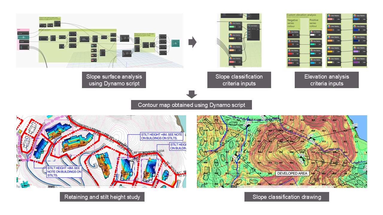
Repeatable model and drawing updates supported the assessment of alternative levels and layouts as the masterplan evolved. The resulting studies gave the design team a clearer basis for reviewing access, building platforms and earthworks together.
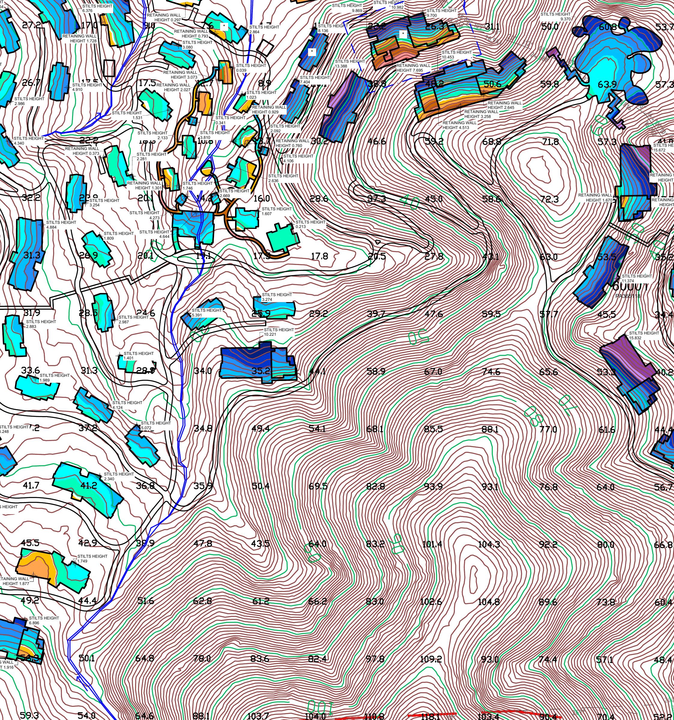
Stilt and retaining heights were mapped against the ground profile to identify where building levels would require tall supports or substantial retaining structures. The study informed the review of platform levels, earthworks and buildability.
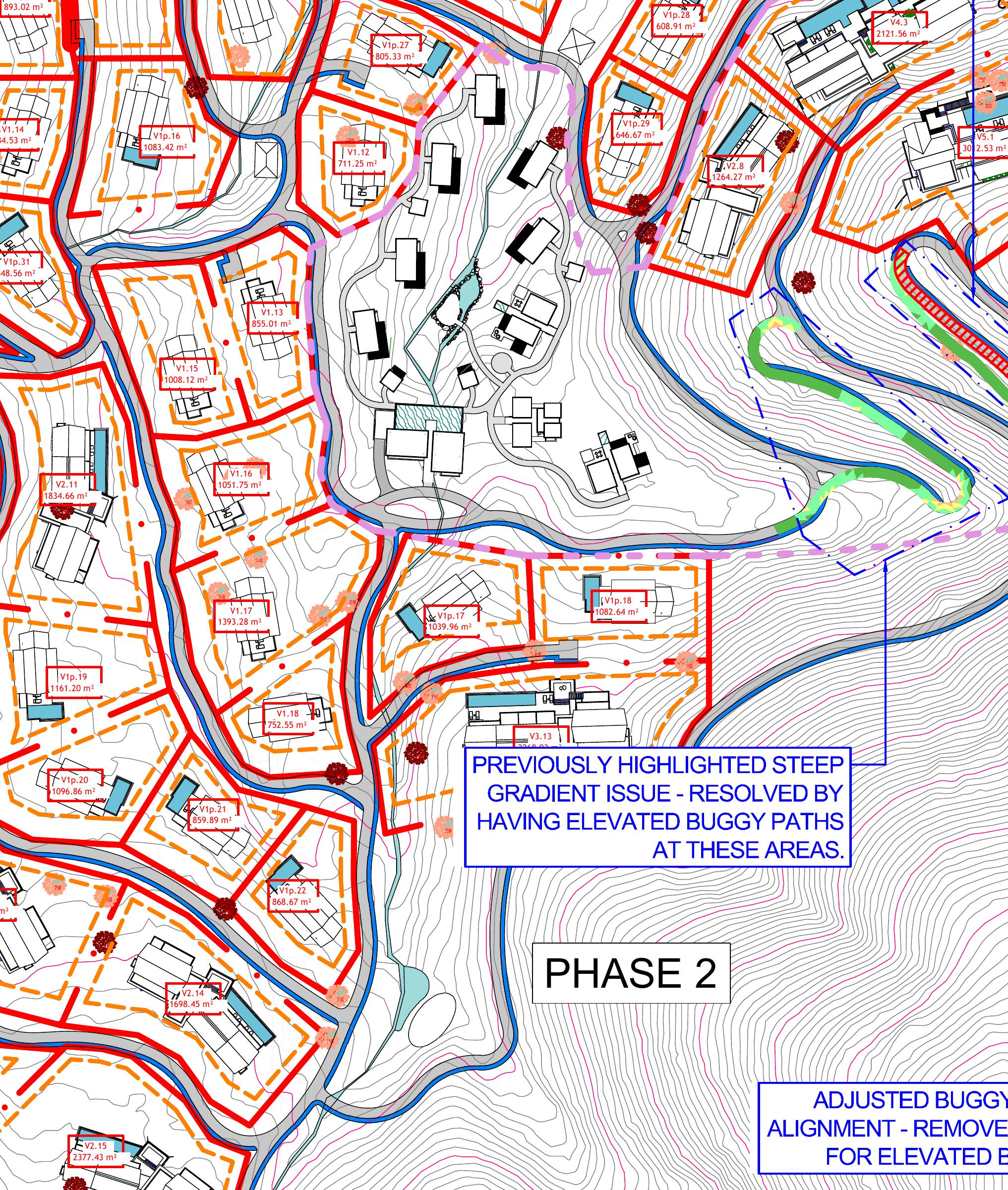
The gradient study highlighted steep sections and tested changes to path alignments and levels. Vehicle capabilities, villa access, existing trees and earthworks were considered together.
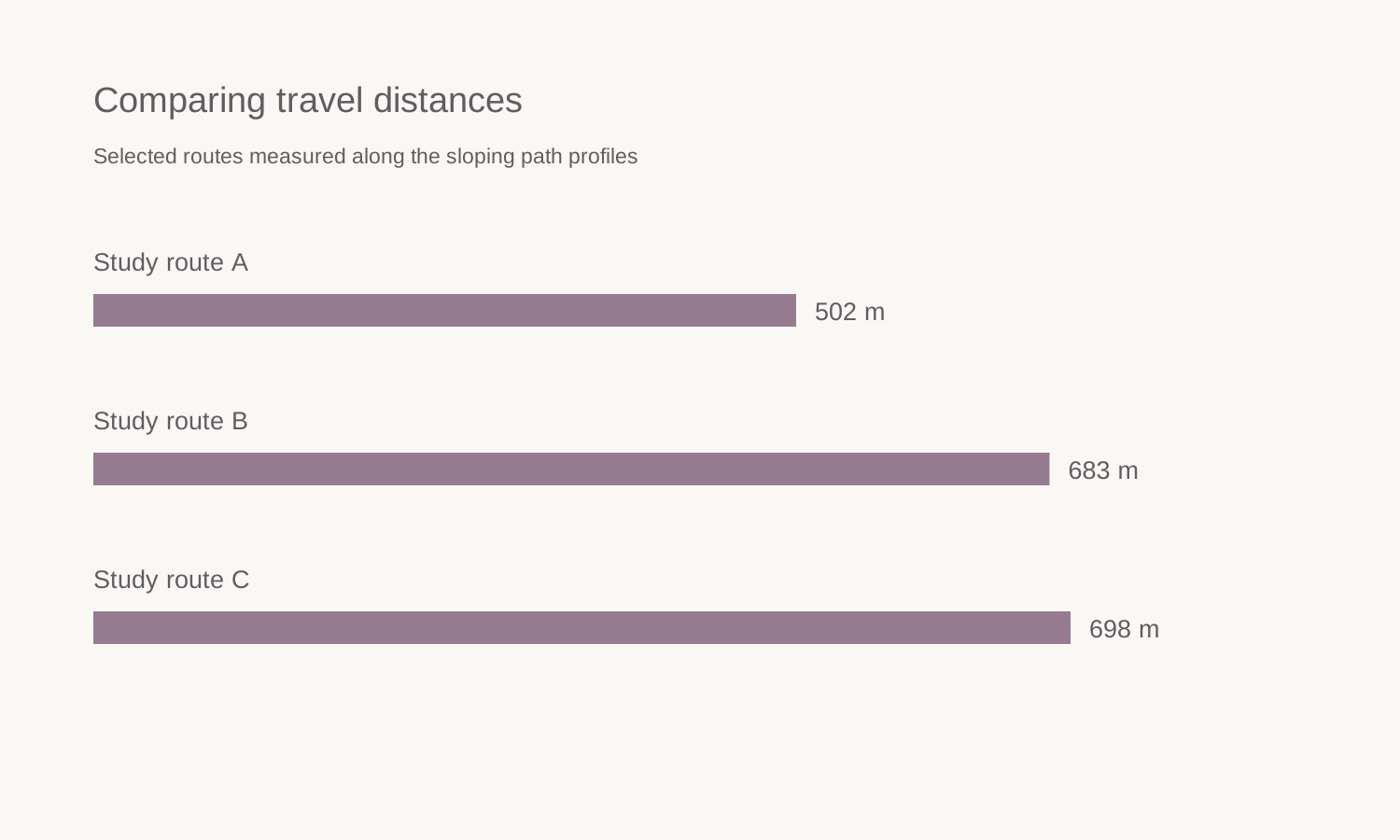
Distances measured along the sloping path profiles supported discussions with the operators about journeys between villas and buggy stations, service times and the practicality of the proposed network.
Visual: DL2A, France; RPA; Linear Vista
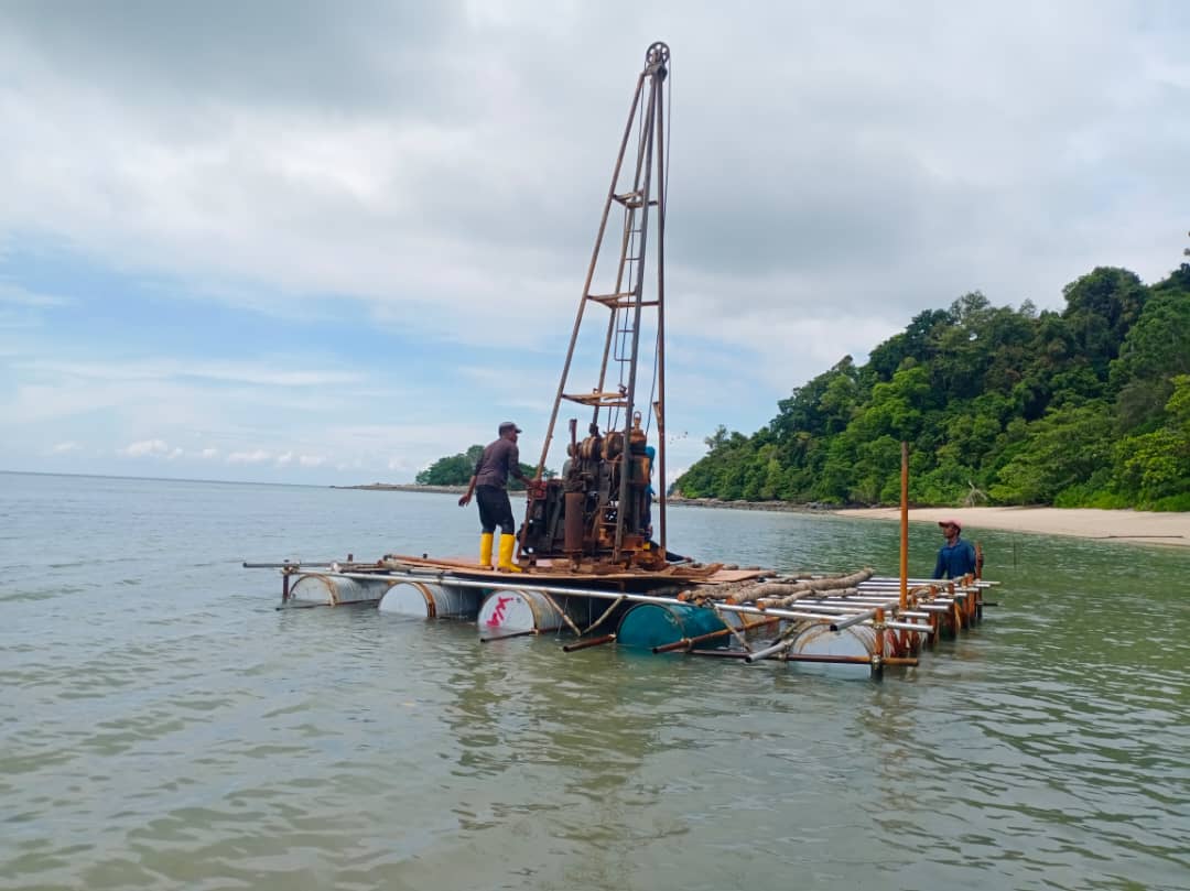
As part of the soil investigation, a borehole was carried out at sea from a floating drilling platform.

A self-crawling rig was used to negotiate the steep, forested slopes, enabling ground investigations to be undertaken in areas with difficult access while minimising the need for extensive temporary access works.